The influence of the natural landscape
Topic 2: The influence of the natural landscape
When we look at the landscape, we are seeing the effects of natural processes (the natural landscape) and the effects of people (the cultural landscape). In this section we will be looking the different features of the natural landscape, and how they were formed.
Valleys
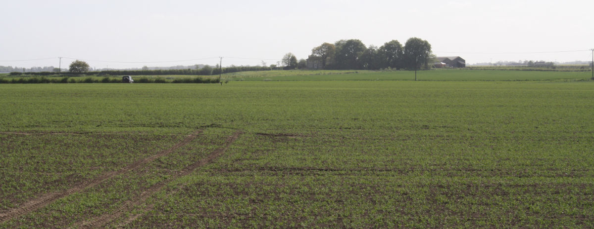
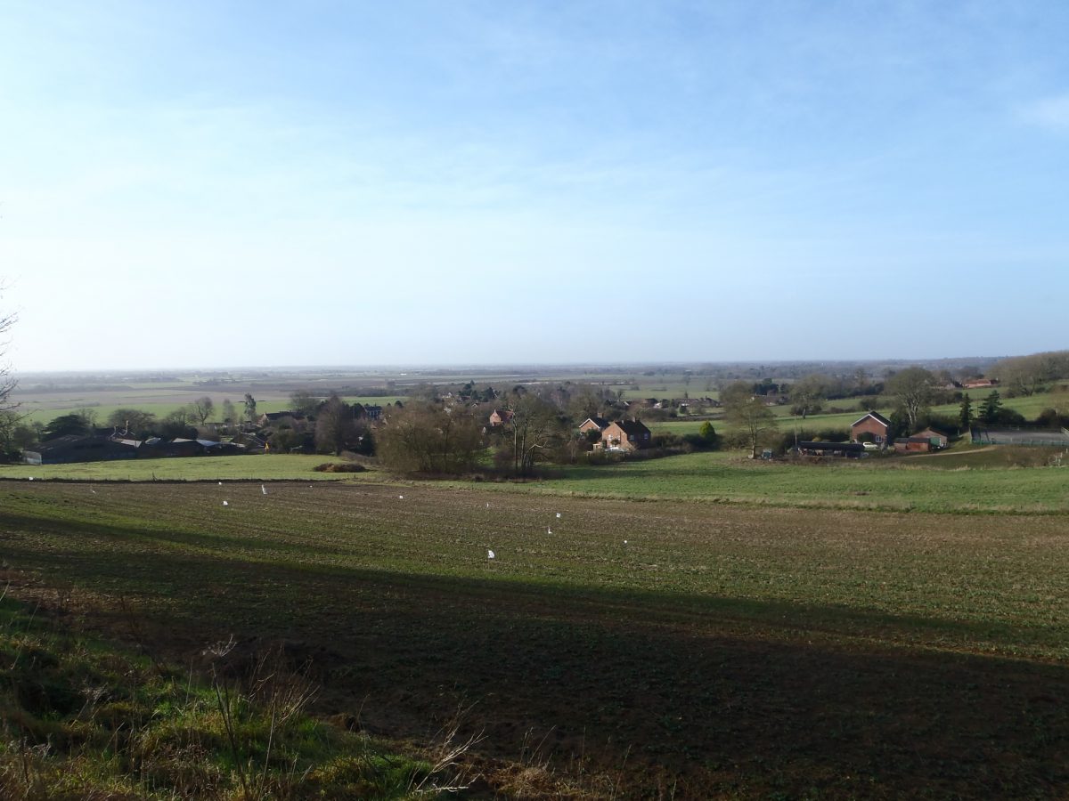
Trent Valley, seen from Scampton
This is a view looking west from the top of a hill, across the floor of a valley. On the surface, the natural landscape is composed of trees and grass, with possibly a few wildflowers growing here and there. Much of the land, however, is cultivated. The species of plants found together in a landscape are often specific to an area. Identifying the different species of plant can provide clues about the local soils, rock formations and climate.
Look at the picture again. Much of the land is flat and low lying. This is a common feature of the bases of valleys. Somewhere within this land will be the course of the river Trent, and smaller tributary rivers that feed into it. Sometimes you can see the course of a river or stream as a curvy line of trees.
Valleys are formed in a number of ways, either by erosion by rivers (such as the Trent Valley) or carved by meltwater during the last period of glaciation.
The northern end of Ancaster Valley
This photograph of the Ancaster valley shows the u-shape profile of a valley created by glacial meltwater.
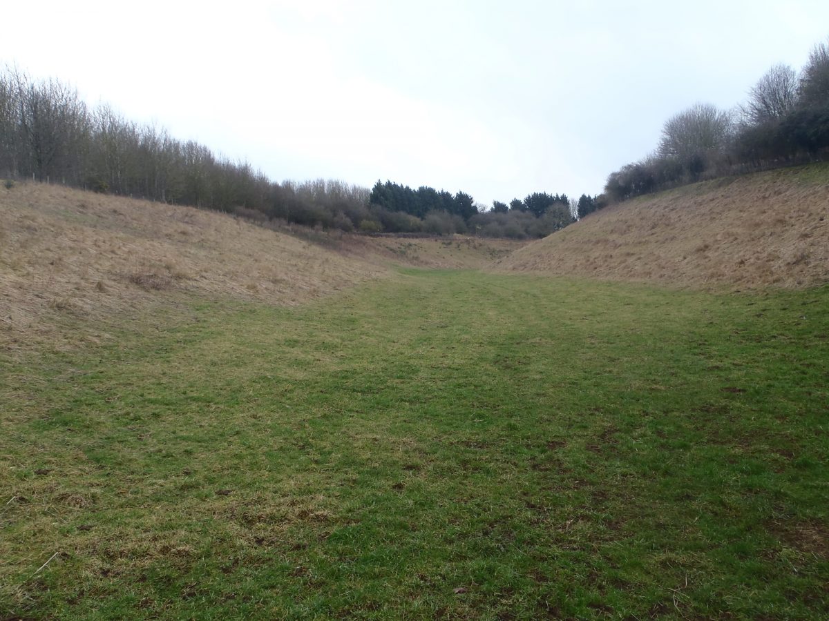
Dry valley on the Lincolnshire Edge near Ancaster
Dry valleys, such as those found in the chalk Wolds in the northeast of the county, are often referred to as dales.
Ridges
In addition to valleys, Lincolnshire also has hills and ridges.
Stickney Moraine
View towards north end of Stickney Moraine.
This photograph shows the area Stickney Moraine, which was formed from earth and rubble pushed in front of the ice sheet during the last period of glaciation (approximately 20,000 years ago). Geologists use this as a marker for the final extent of the ice sheet, that came in from the north sea. However, as this ridge is not very high, it can be difficult to make it out with the naked eye.
Here an archaeologist would use a detailed map or LiDAR (Light Detection and Ranging) image which shows the relative height of the land. Look at the LiDAR image below, and you can see the shape of the moraine, even though it is just a few metres tall.

LiDAR image of the fenland north of Boston. The slightly higher moraine can be seen in yellow
Lincolnshire also has some larger ridges of clay or rock.
The Lincoln Cliff
Lincoln cliff at Wellingore showing scarps.
The Lincoln cliff, is a north-south aligned ridge of limestone that forms the west side of the Trent Valley. The slope of the cliff appears to have steps in it, these are caused by rotational land slip, and are called scarps.
The Wolds
View across the Wolds from Normanby le Wold.
The Wolds was originally a plateau, but the effects of ice and meltwater during the last period of glaciation have created the undulating landscape that can now be seen.
Fens
As well as ridges, hills and valleys, there are large areas of low lying fens in Lincolnshire. These are areas that were, until recent centuries, wide expanses of marshes and shallow lakes. Now they have been drained, but you can still see the wriggling lines of creeks that flowed through them.
View across the Fens looking towards West Keal.
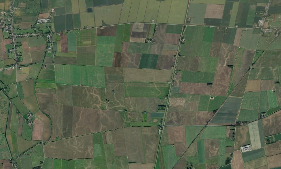
This aerial photograph clearly shows the paler sandy creeks
Coastline
Lincolnshire has a coastline that has expanded slowly over the centuries. This is because sand and silt are washed up on the shore by the sea. Where the sea meets the land is usually a beach, behind the beach form dunes of windblown sand, and areas of saltmarsh. Eventually the saltmarsh is reclaimed as agricultural land.
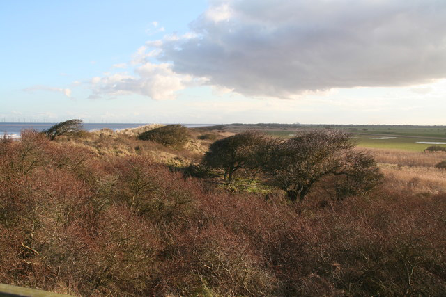
View from dunes at Anderby Creek
Supplementary Information : Lincolnshire Landscape Character Areas.
Lincolnshire is a large county with a range of natural landscapes. These have been divided into a number of landscape character areas by Natural England:
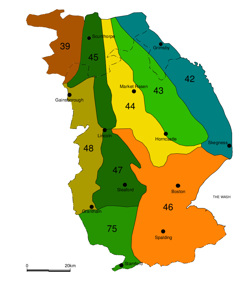
Map of Lincolnshire landscape Character Areas
The landscape in these areas is very much affected by the underlying geology of Lincolnshire, as can be seen on this simplified Geological map:
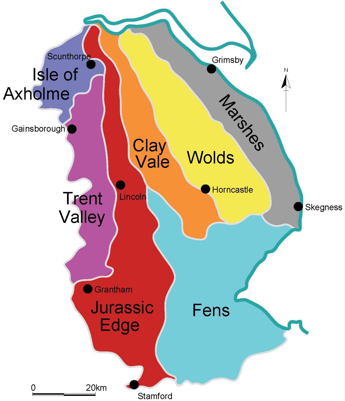
Simplified Geological Map
The Landscape areas also contain distinctive physical features such as hills and vales. These will be highlighted with hill shaded maps of each landscape area, The blue areas are low lying, and the green, yellow and red areas are progressively higher.
Area 39 – The Humberhead Levels
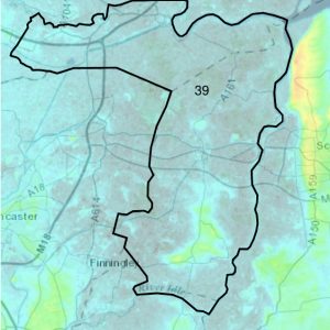
In the northwest of the county is Landscape Area 39, the Humberhead Levels.
This is a low-lying, predominantly flat landscape, at or below mean high-water mark and maintained by drainage.
The soils are predominantly sandy and silty. The Isle of Axholme forms an area of slightly raised ground, that was formerly surrounded by marshlands.
Landscape Area 48 – The Trent Vale
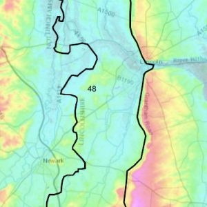
To the southeast of the Humberhead Levels, is the Trent Vale, extending into the Belvoir Vale in the southwest of the county (Landscape Area 48).
A gently undulating and low-lying landform in the main, with low ridges dividing shallow, broad river valleys, vales and flood plains. The River Trent flows north through the full length of the area.
The bedrock geology of Triassic and Jurassic mudstones has given rise to fertile clayey soils across much of the area, while extensive deposits of alluvium and sand and gravel have given rise to a wider variety of soils, especially in the flood plains and over much of the eastern part of the area.
Landscape Area 45 – the Northern Lincolnshire Edge with Coversands
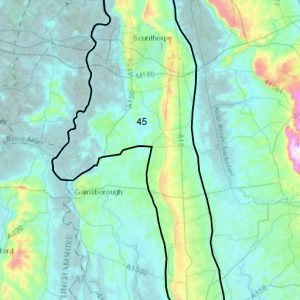
Northeast of the Trent Vale, is Landscape Area 45, the Northern Lincolnshire Edge with Coversands.
This is an area of elevated arable landscape with a distinct limestone cliff running north–south, the scarp slope providing extensive long views out to the west. The ironstone double scarp around Scunthorpe and extensive areas of wind-blown sand, the Coversands, give rise to infertile soils supporting heathland, acid grassland and oak/birch woodlands.
The underlying limestone supports small areas of calcareous grassland. There are few watercourses on the plateau, which lies between the rivers Trent and Ancholme which flow into the Humber, and is cut through in the south by the River Witham.
Landscape Area 44 – the Central Lincolnshire Vale
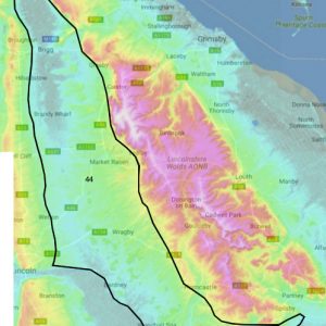
East of the Northern Lincolnshire Edge is the Central Lincolnshire Vale (Landscape Area 44).
This is a predominantly broad, low-lying, very gently undulating arable vale with a bedrock, chiefly of Jurassic mudstones and almost entirely covered by a variety of superficial deposits, largely of glacial till (boulder clay).
The Wolds scarp provides a prominent boundary to the east. The soils are seasonally waterlogged loamy clay, with lighter loams towards the Wolds and sandy soils on the Fen Edge Gravels and the wind-blown Coversands.
Landscape Area 43 – the Lincolnshire Wolds
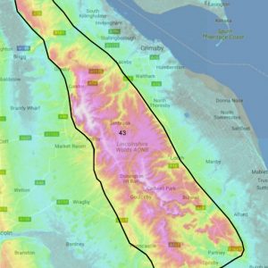
East of the Central Lincolnshire Vale is Landscape Area 43, the Lincolnshire Wolds.
This is an area of rolling chalk hills and a predominantly agricultural landscape with a pronounced scarp edge to the north and west affording panoramic views across the surrounding land.
A diverse geology of chalk, sandy limestone, ironstone and clay gives rise to a combination of elevated plateau and deep-sided dales. Soils are generally shallow and lime rich with rich loamy soils associated with valley bottoms.
Landscape Area 42 – the Lincolnshire Coast and Marshes
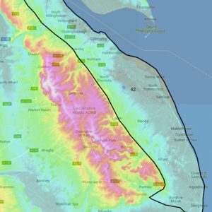
The northeast coast of Lincolnshire is described as Landscape Area 42, the Lincolnshire Coast and Marshes.
Flat coastal plain to the east, rising gradually in the west to more undulating land at the foot of the adjacent Lincolnshire Wolds. Cretaceous Chalk underlies most of the area with later Quaternary sand, gravel and clay deposits laid down following glacial activity. Slowly permeable, seasonally waterlogged fine and fertile loamy soils.
Strong marine influences of accretion and erosion shape the coastline with extensive wide, shallow beaches, vast areas of mudflats, major dune systems, continuous lengths of artificial sea defences, and numerous sandy beaches and nature reserves.
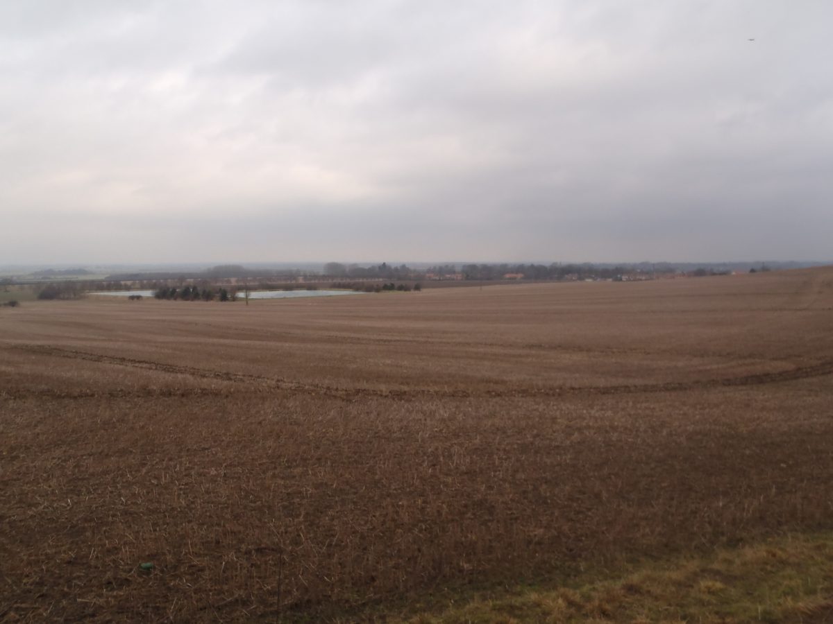
Landscape Area 46 – The Fens
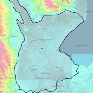
The southeastern quarter of the county is dominated by Landscape Area 46, The Fens.
This area is characterised as expansive, flat, open, low-lying wetland landscape influenced by the Wash estuary. Jurassic clays are overlain by rich, fertile calcareous and silty soils over the coastal and central fens and by dark, friable fen peat further inland.
The Wash is the largest estuarine system in Britain, supporting internationally important intertidal and coastal habitats influenced by constant processes of accretion and deposition, forming salt marsh and mudflats.
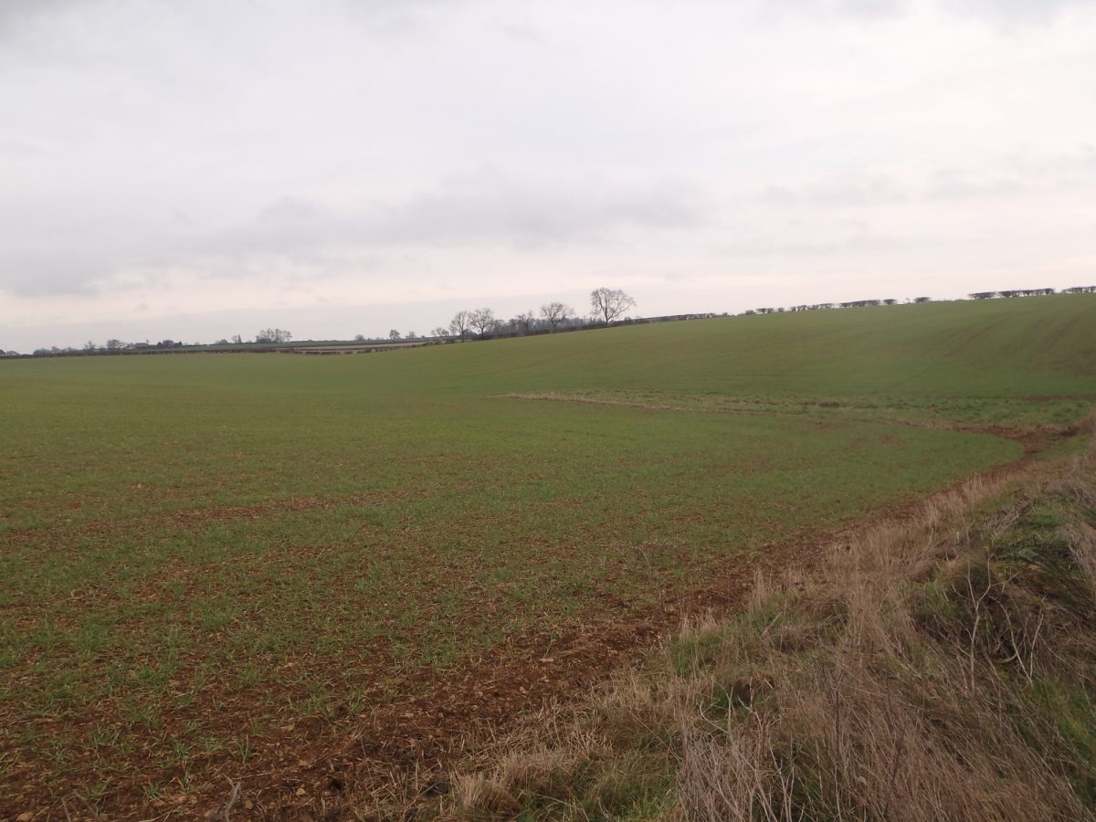
Landscape Area 47 – the Southern Lincolnshire Edge
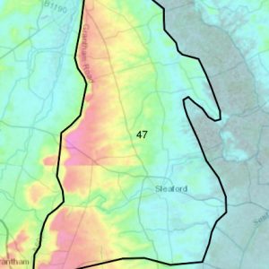
To the west of the Fens, is Landscape Area 47, the Southern Lincolnshire Edge.
This is an elevated arable escarpment with a distinct cliff running north–south along the western boundary, providing far-reaching views over the Trent and Belvoir Vales.
Productive loamy soils on the limestone plateau, give rise to a large-scale open landscape of arable cultivation with large, regular fields and few boundaries of tightly cut hedgerows or rubble limestone walls. Heavy clay soils in the east and south-west of the area, support more grazing land in smaller, less regular fields, along with small areas of woodland and parkland.
Landscape Area 75 – the Kesteven Uplands
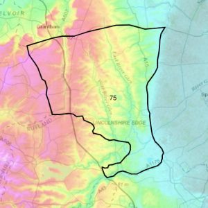
South of the Southern Linconshire edge is the Kesteven Uplands, Landscape Area 75.
This is an undulating mixed farmland landscape gently rising from the Fens in the east to the limestone ridge in the west. Large arable fields predominate on the higher ground of the Kesteven Plateau, with clipped and gappy hedgerows, while heavier land in the river valleys provides good grazing for cattle and sheep.
Underlying limestone supports shallow, well-drained calcareous loams, with areas of less permeable clayey soils developed on glacial till.