Online research
Topic 1: Online research
Online research has the advantage of being available in the comfort of your own home and at any time that suits you. It can provide a variety of information about a site, and can help you locate other sources of information in museums and archives.
When you have seen something in the landscape (some curious mounds for example) you may want to find out more about them. The first thing to do is locate them, and this is quickly done using google maps.
Google maps
This is a popular mapping site
When you first access the page, you will see an outline map, look for a green square in the bottom left corner marked Earth. Click on this, and the outline map will be replaced by aerial photographs.
Google Maps
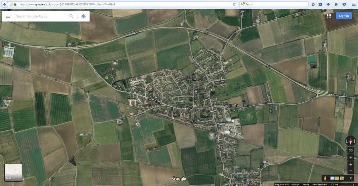
Google Satellite View
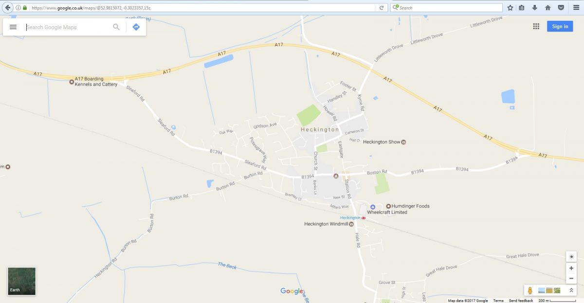
Now we need to get close to our mystery feature. In the top left hand corner of the page, where it says “Search Google Maps”, type in the name of the nearest village to your feature. Google maps will now zoom into that village.
Google Map Zoom
Use the – button in the bottom right corner, or the wheel of your mouse, to zoom out slightly and start looking for your feature. Hopefully you will be able to make it out the feature, so you can see its shape in plan and know precisely where it is located.
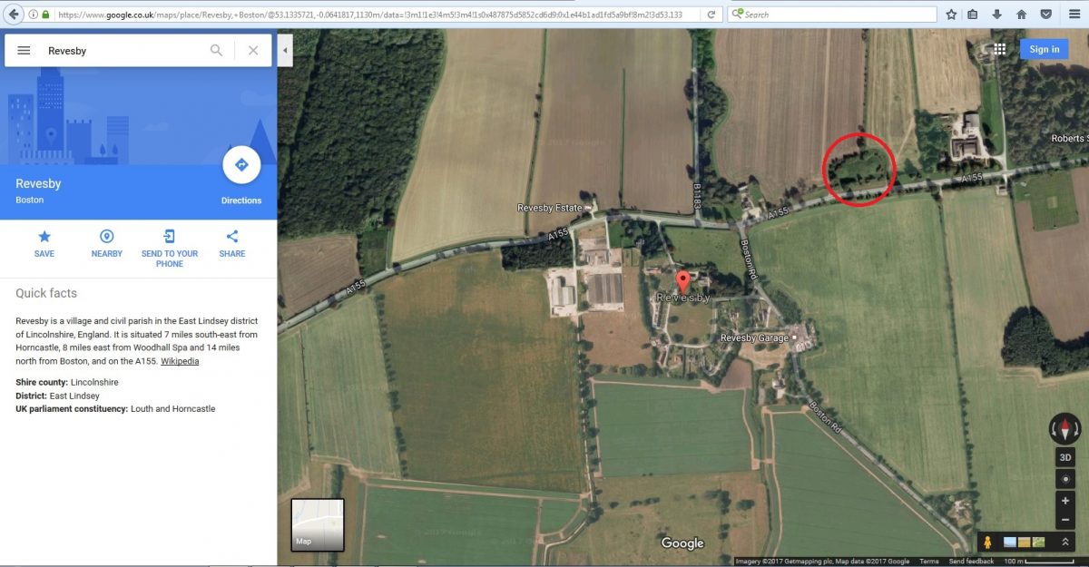
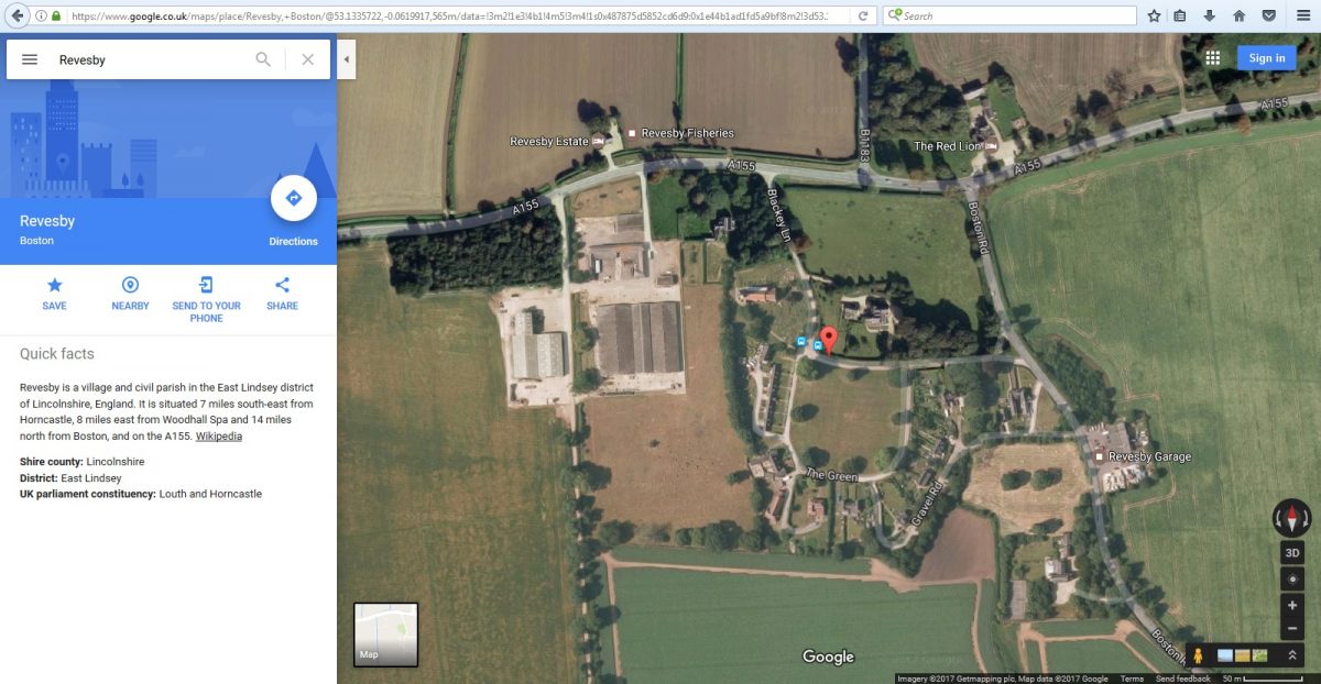
Seeing the feature from above might give you a better idea of what it is. More importantly having a map location you can refer to can allow you to use other internet resources.
Old Maps
This site allows you to look at old maps of the area you are researching.
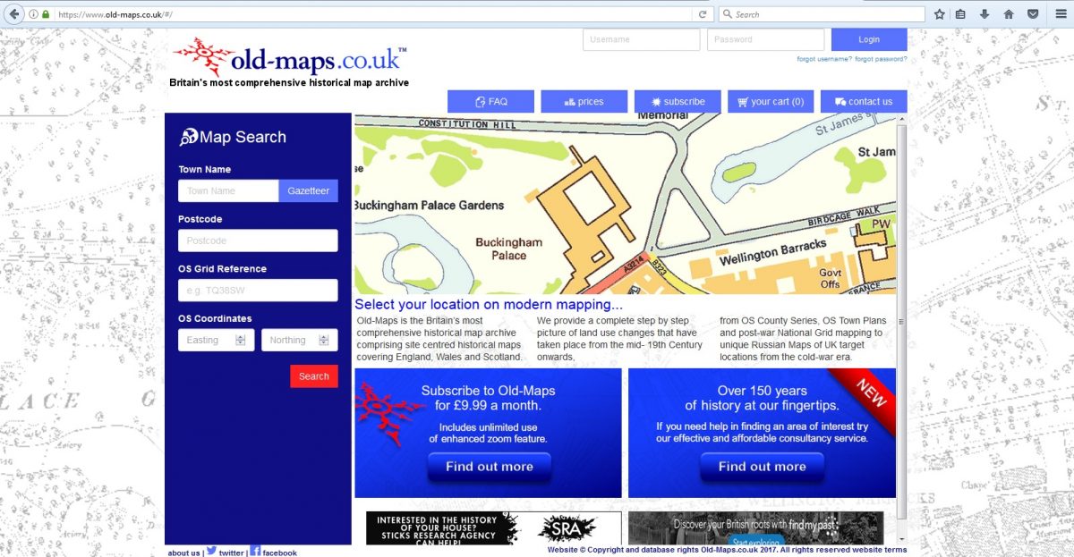
Old Maps
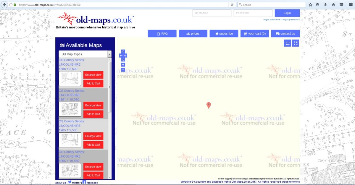
1
On the left hand side, where it says Town Name, type in the name of your village. This will bring up a picture frame, with a menu of different maps from different dates. You may need to zoom out to see where you are.
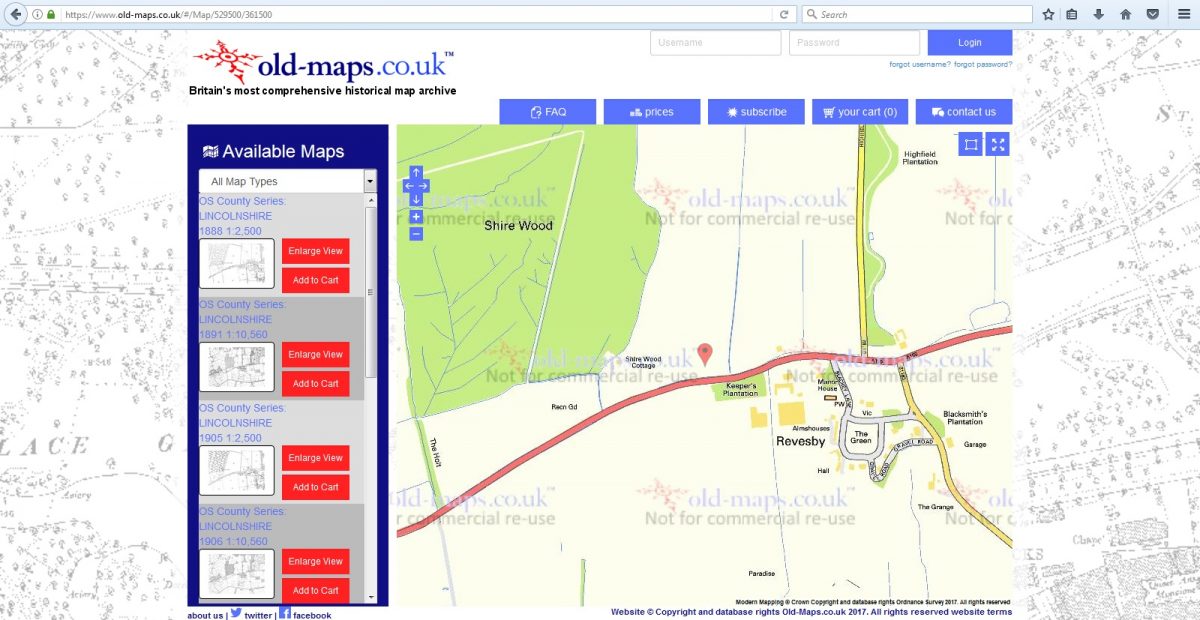
2
Using Google Maps as a reference, locate your feature and click on the map to centre you search on this spot.
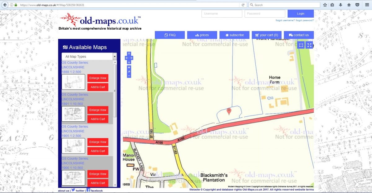
3
Now select a map from the left hand side and see what it shows you.
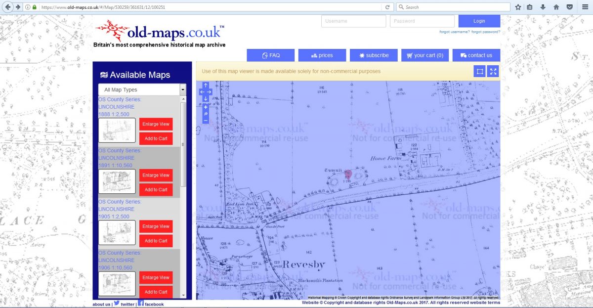
This will let you know if the feature is over 100 years old, or if it is younger, when it first appears on a map. It can also indicate if there were any associated features that have now disappeared.
The other thing that can be traced through old maps are the lines of historic streets and old street names. These often provide clues to the medieval development of villages and towns, and will be discussed in greater detail in the Medieval Settlement course.
Heritage Gateway
This is a site that links to over 60 sources of historical and archaeological information, and it is therefore a very useful starting point for research.
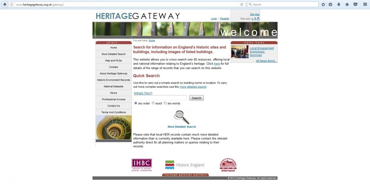
Heritage Gateway
1
When you access the home page, it will give you basic search option. This can be useful for find specific types of sites or objects, but we want to look at a specific location. For that we need to select the “More detailed Search” on the menu at the left side of the screen.
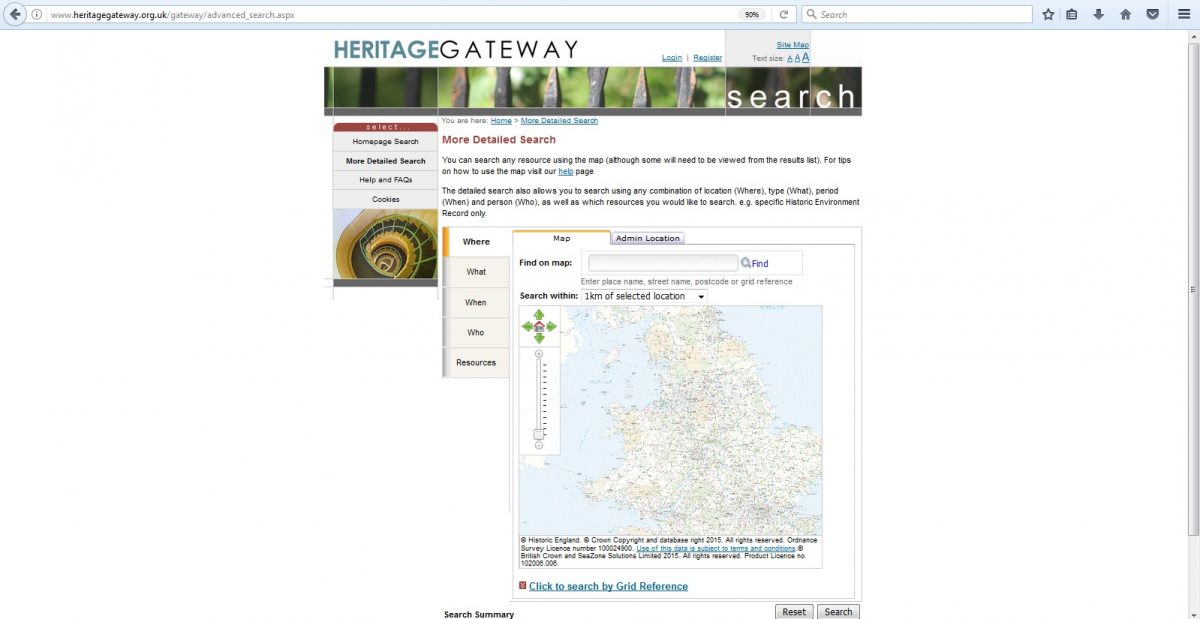
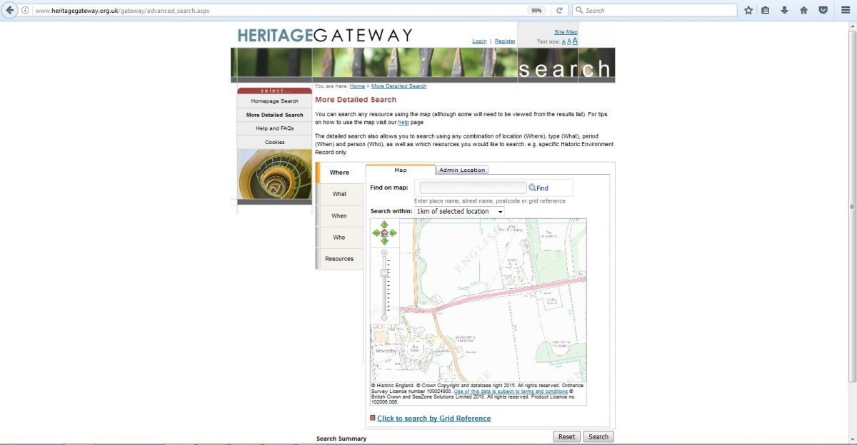
2
The first option in the more detailed search is location and there will be a map of the UK. Zoom into Lincolnshire and, using Google Maps as a reference, find the location of the feature you are interested in.
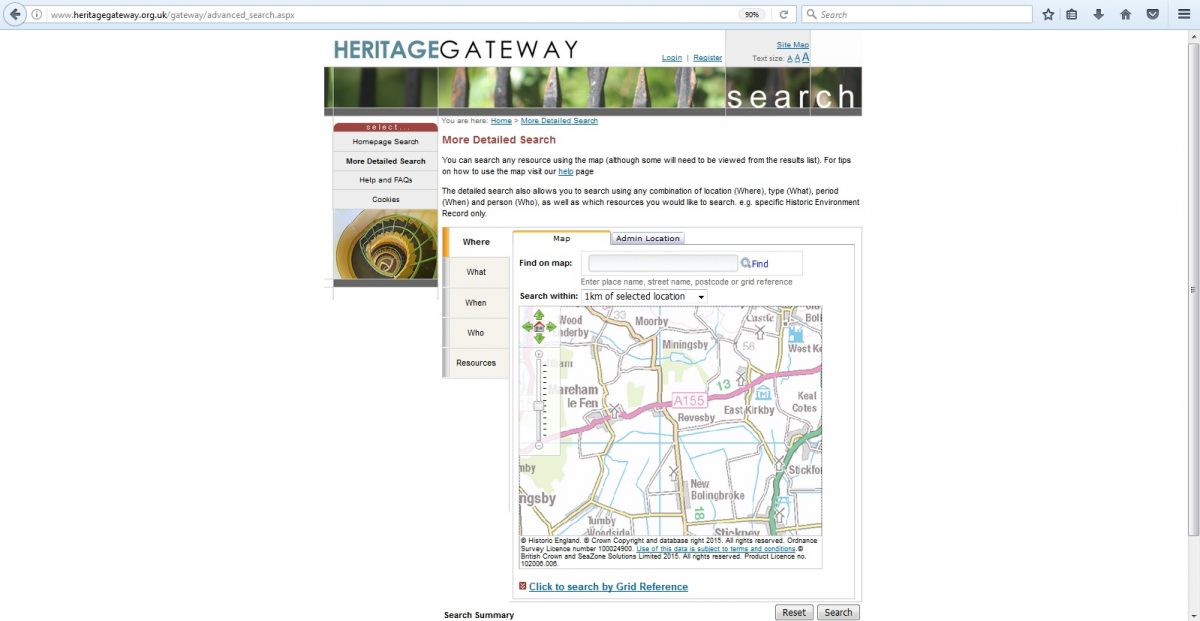
3
Click on that point and you get a highlighted box 2km square, centred on that point. If you were to press search (bottom right) at this point you would get records relating to everything within 1km of your feature of interest.
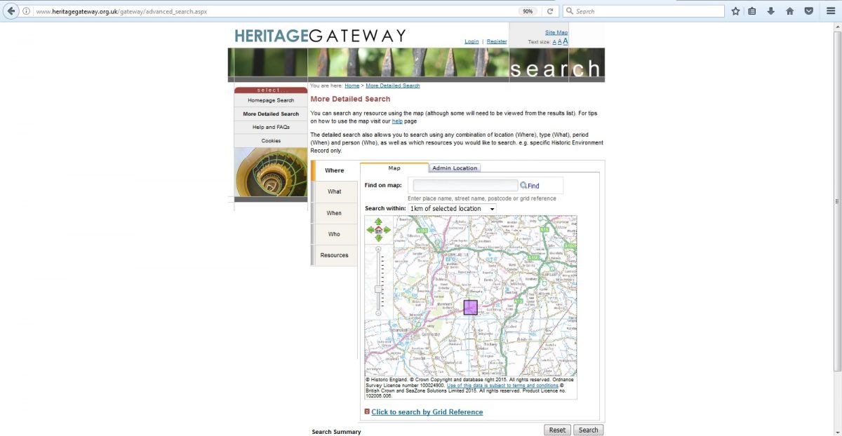
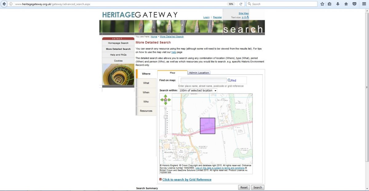
4
This is probably too much information. Reduce the area searched by using the menu at the top of the picture. The smaller the area, the fewer records and the easier it will be to find the information you require. Now press search.
5
You will now be given a summary of results. On the left, in blue, is the title of the source of information, e.g. “The National Heritage List for England”, and to the right will be an indication of how many records found.
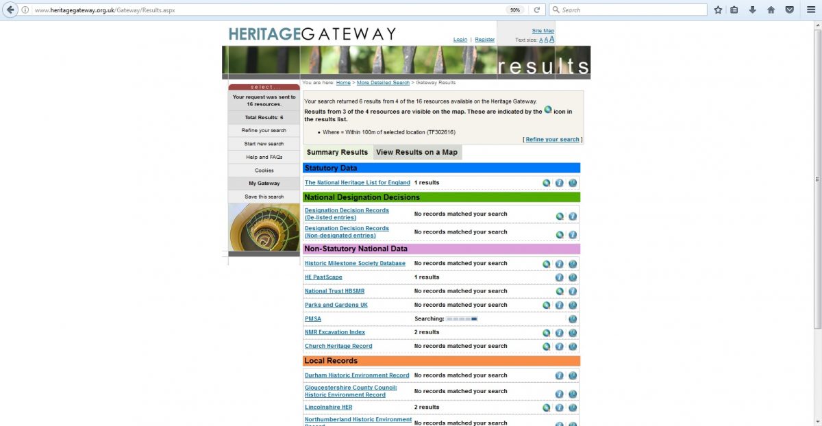
6
If you click on the blue title, it will expand to give you a description of the information source and a link to each record in that source (Blue title on left, underlined).
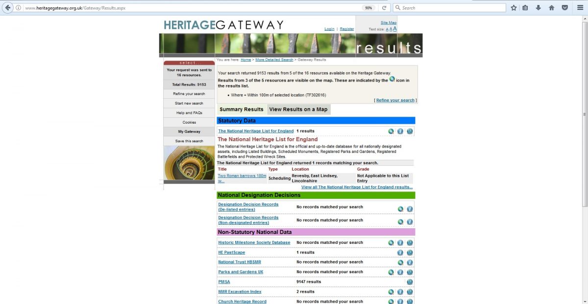
7
Click on the link and the site will take you to a page of information about that particular feature or object.
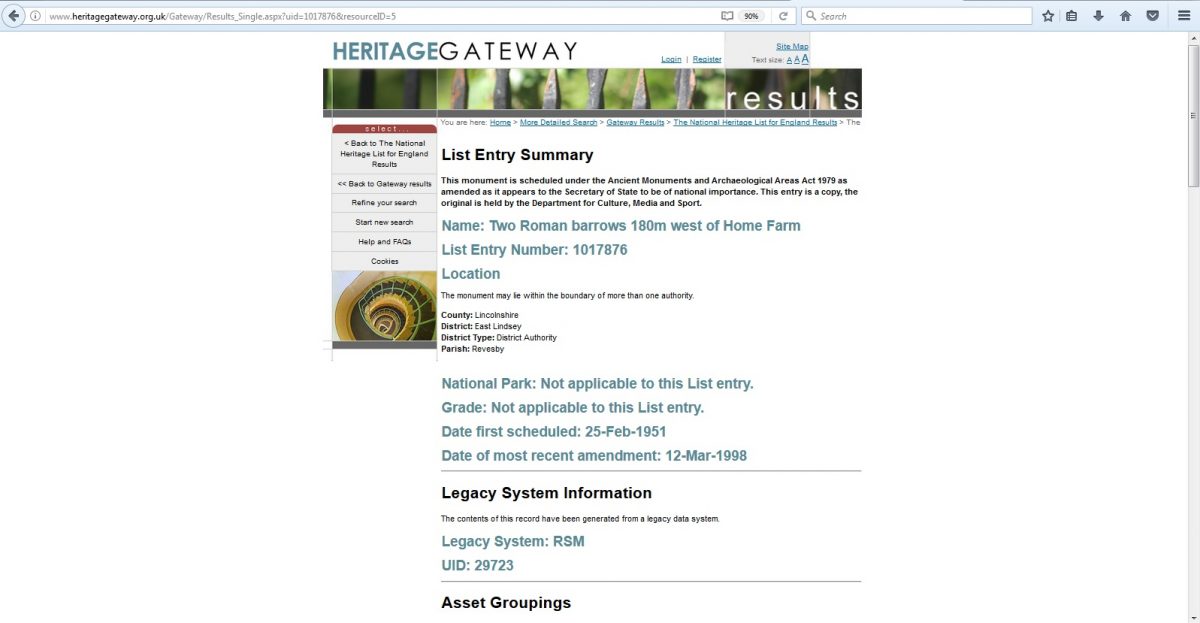
Different landscape features will have information stored in different places, so it is worth checking each title in the summary. Not every record will relate directly to the feature you have seen, but they may provide information about related unseen features.
Of particular interest is the section titled Lincolnshire HER. HER stands for Historic Environment Record and is a composed of many thousands of individual records relating to historic buildings, buried archaeological remains, reports of found objects, and much more. For archaeologists, this is one of the most important sources of information we use. The additional advantage of the HER, is that they can be contacted directly, and their staff are available to assist you in your enquiries.
For further information about the Lincolnshire HER, go to https://www.lincolnshire.gov.uk/residents/environment-and-planning/conservation/historic-environment-record/
Lincs to the Past
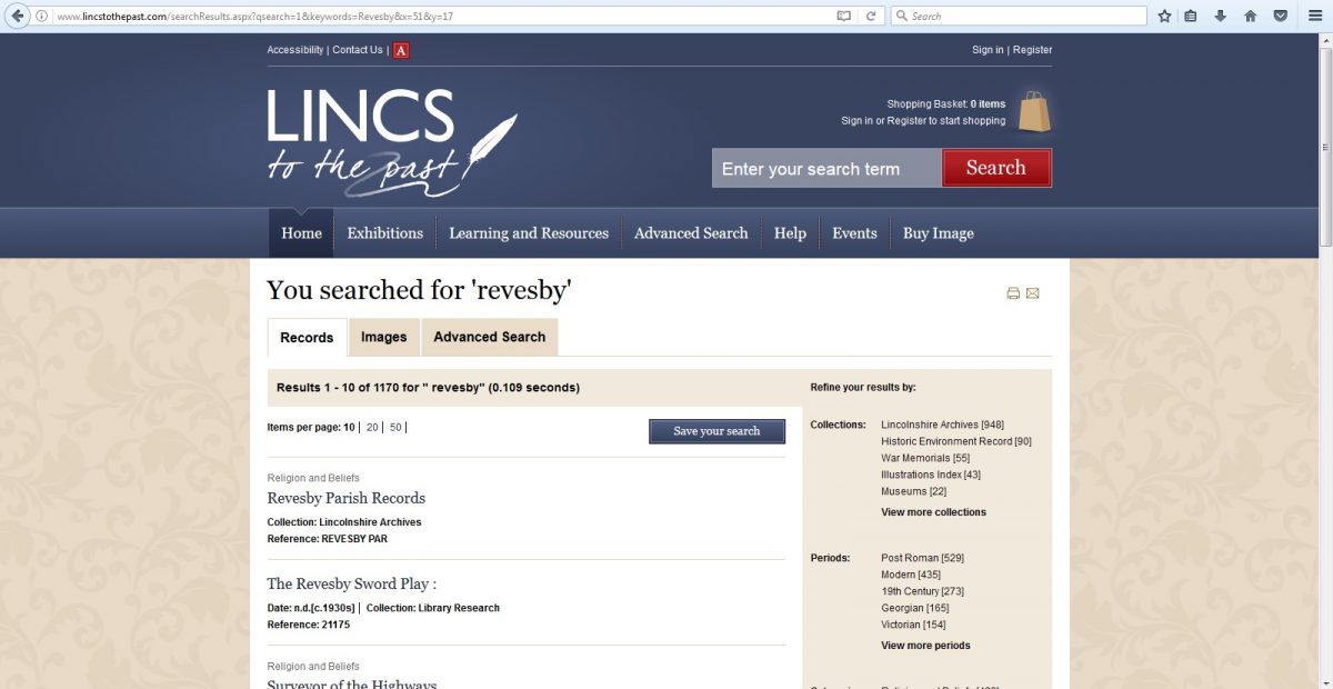
Lincs to the past is a useful website for anyone researching any aspect of Lincolnshire’s past. It provides an online catalogue search of historical records such as the archives, the libraries and the various collections of historical objects and manuscripts.
The basic search bar (top right) will find a variety of information, some of which will be instantly available on line, but others must be seen first-hand. For this, the site helpfully provides the physical location of the record (e.g. the archives at Lincoln) and the reference code to help you find or request the item.
It is also a great site to browse and widen your knowledge of Lincolnshire’s past.