Map of Roman Lincolnshire
The landscape in Roman Period was studied by the Holbeach-born antiquarian Dr William Stukeley (1687-1765).
Here his early 18C map features the main elements: roads, dykes, rivers and settlement.
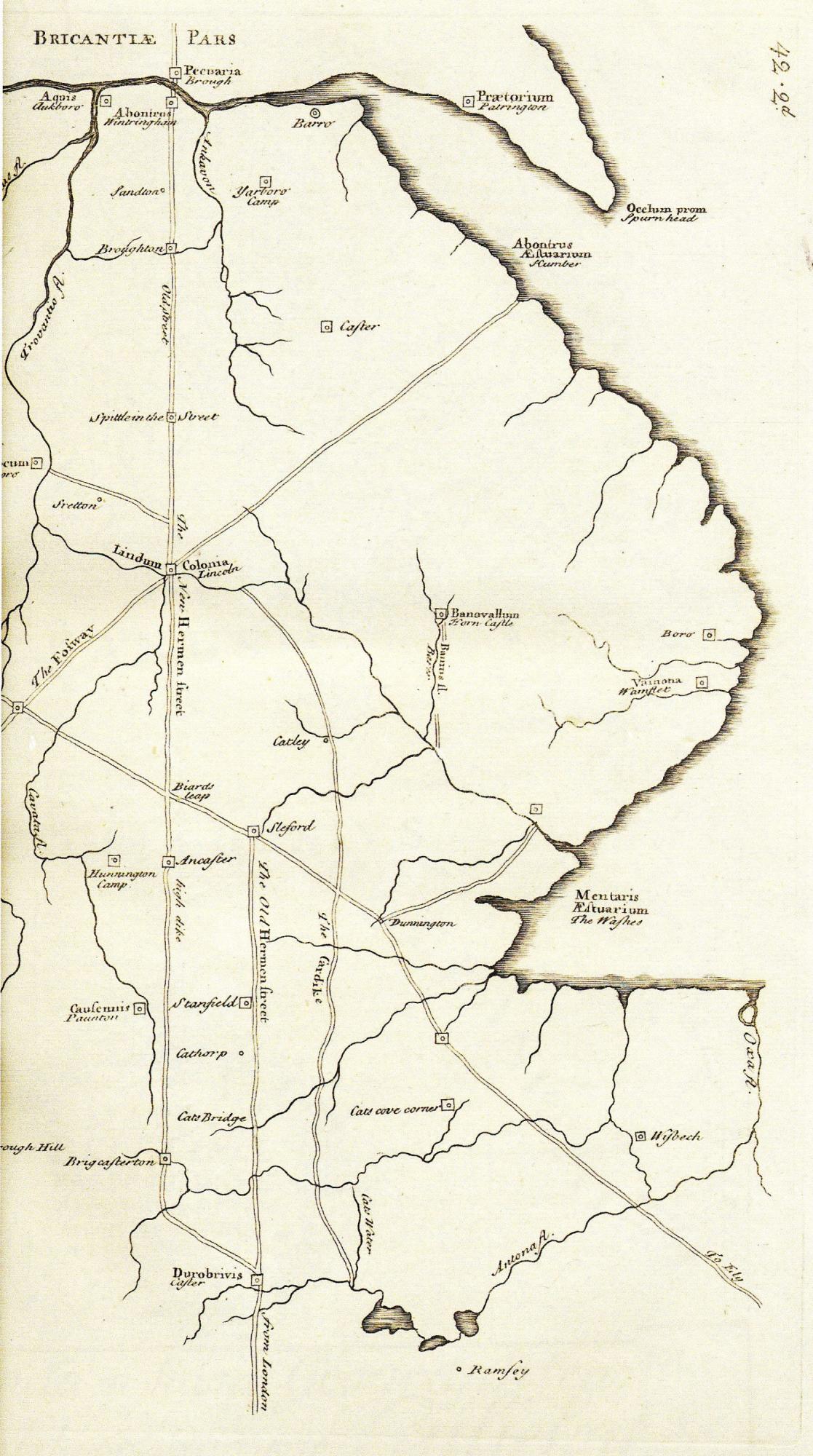
William Stukeley’s map of Roman Lincolnshire (original held at Lincoln Archives)
Note the straight major roads, Fosse Way and Ermine Street, but also ‘Old Hermen Street’.
What is a fosse?
Note ‘The Cardyke’ ditch (part canal according to Stukeley) along the western edge of the East Anglia Fens. Drainage ditches to improve farming territory were the key factor in man-made landscape. Large Drains are still seen today. Dykes prevented flooding, and kept out the sea. Over time engineers, skilled in designing canals with embanked sides, saw the value of making rivers navigable for trade.