Parliamentary Enclosure Award
Topic 3: Parliamentary Enclosure Award
Having looked at the early ordnance survey maps and the google earth image, we can see that there are several layers of landscape that can be teased out to reveal the medieval village plan.
To try and confirm this we need to look at older documents such as the Parliamentary Enclosure award for the parish, tithe maps and other documents such as tax rolls. These, where they exist, are all available from the Lincoln archives and a search in Lincs to the Past will provide you with details.
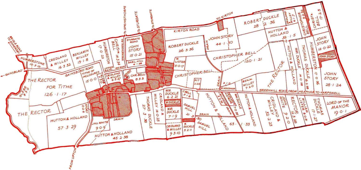
In Lincolnshire we are fortunate that there are a number of published works showing the effect of Parliamentary enclosure on the landscape. In this case, Making New Landscapes in Lincolnshire by Eleanor & Rex C Russell, has an interpretation of Heapham enclosure:
Heapham’s enclosure
By consulting the surveyor’s documentation, the authors have created two maps:
Fields
- The map of Heapham after enclosure (red) confirms that the majority of the large regular fields date from this time.
Roads
- The surveyor’s documents also confirm that seven public roads were laid out at the time.
- Enclosure roads from the 1770’s had a required minimum width of 60 feet to reducing rutting and allow the droving of livestock.
- Where the surveyors are creating new roads over open fields, the roads are simple straight lines (Upper Gainsborough Road, Springthorpe Road, Sturgate Road, Kirton Road and Greenhill Road).
- Existing roads, which were little more than footpaths, were widened and straightened (Gainsborough Road and the Road from Upton).
Names
- There are areas of previously enclosed land, mainly in the form of small plots that extend from the original village streets.
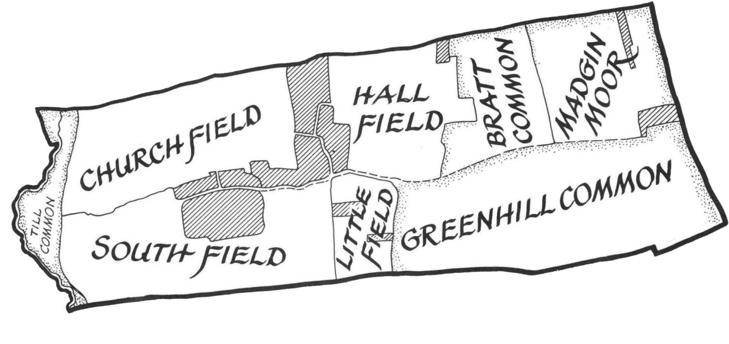
- The names of the open fields provide some interesting information about the earlier settlement.
- On the west edge of the parish is Till Common, probably the area subject to flooding by the River Till.
- At the east end of the parish (on slightly higher ground) are two areas of common grazing (Bratt Common and Greenhill Common) and an area of heath called Madgin Moor.
- In the middle of the parish are four open fields. South Field and Little Field may originally have been a single field extending south from what was probably the main street, oriented east-west.
- To the northwest of the settlement is Church Field, and prior to enclosure, the church sat on the edge of this field, set a little way back from the main street. It is interesting to note that the church lies approximately in the centre of the tilled fields, even though the settlement seems to have grown up a little further south.
- To the east of the church is Hall Field. Field names like this are often a clue that the manor, on which the civil parish was established, was located in this area. In this case we have the confirmation of our observations that there is a medieval moat a short distance to the northwest of Elm Farm.