Ordnance Survey Maps
Looking Further Afield
Topic 2: Ordnance Survey Maps
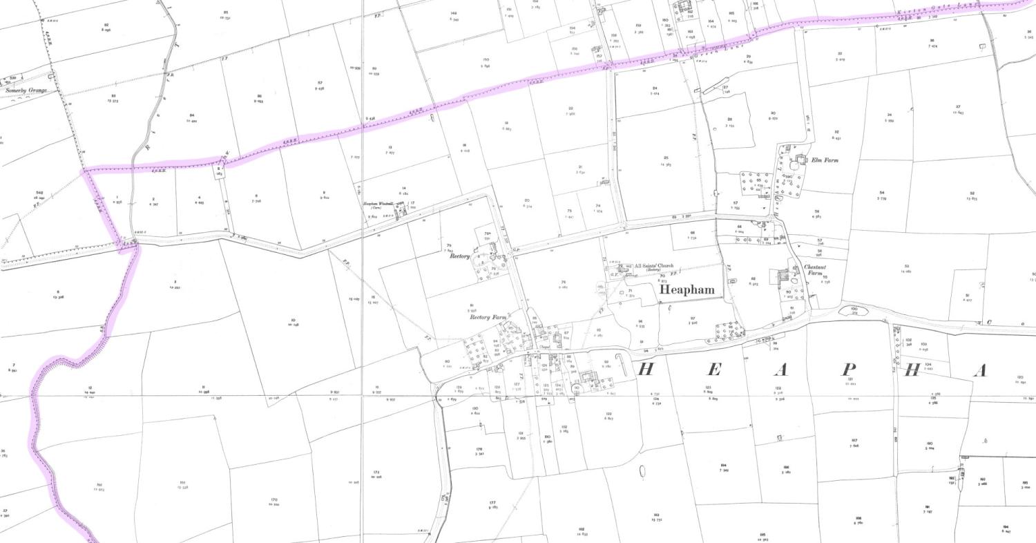
To take a look at how the village was laid out before the creation of the airfield, it is a good idea to look at the old ordnance survey maps. Here is the 1905 25 inch to the mile map, which contains a lot of useful detail.

Tap to make full screen
1
Have a look at the map and pick out all the ponds, and small enclosed fields.
It is quickly evident that ponds were a common landscape feature, and some of these may date back to the medieval period.
You can also see the remains of the long strips of plots that formed fields and yards associated with the medieval settlement.
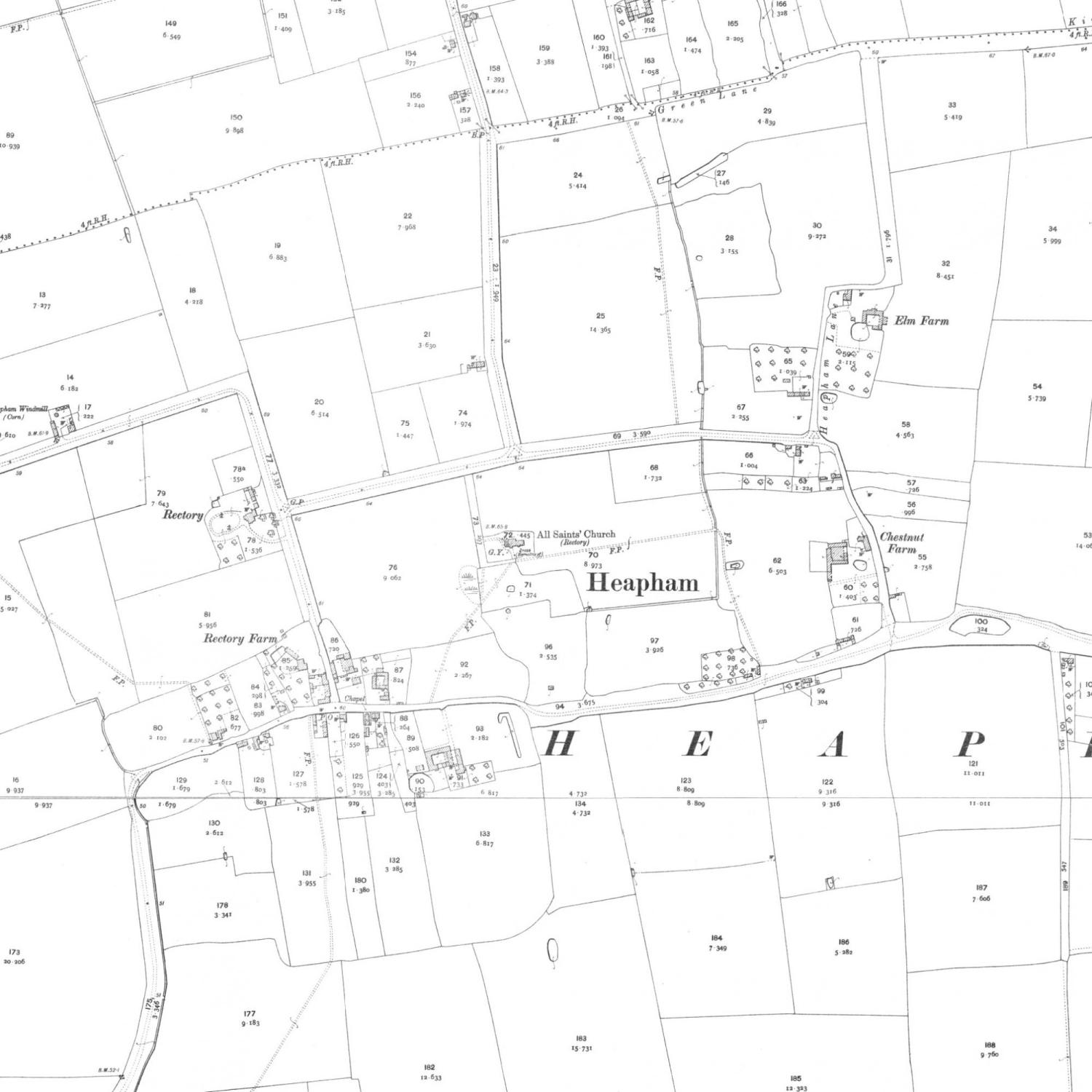
2
The map also indicates another feature which is a remnant of the medieval landscape, in this case the footpaths (green).
If, on the National Library of Scotland (NLS) website, you take the time to follow the footpaths from Heapham, you will find that they link up to old roads and lanes in the neighbouring villages.
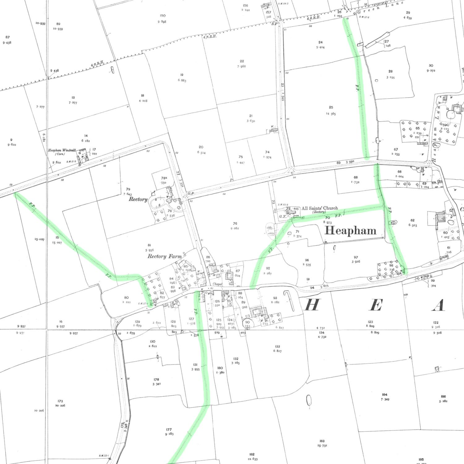
3
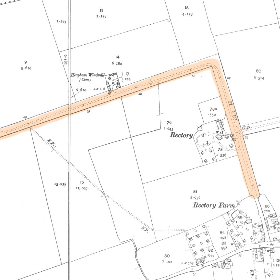
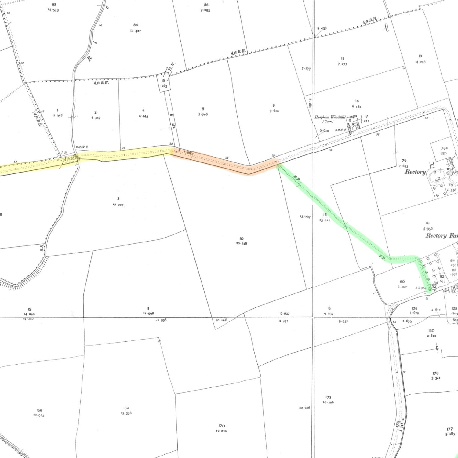
To the west of the village is the road that leads to Somerby.
Looking at the road on the map (orange), running approximately north past the Rectory and then turning 90 degrees west, this looks suspiciously straight and broad and is probably an 18th or 19th century road constructed when the fields were enclosed.
4
The foot path (green), however runs diagonally from the west end of the village, where it joins a more irregular east-west section of road (yellow) that crosses the river Till.
It is possible that this was the route of the medieval road as it ran from the crossing of the Till to the village.
5
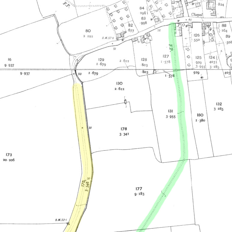
To the south, Common Lane is the main route from Heapham to Kexby, but again there is at least one section that is clearly an 18th or 19th century enclosure road (yellow).
However, there is another footpath (green) that runs in a much more direct line to Kexby, crossing the river Till using a footbridge. Again, it is possible that this is the original road between Kexby and Heapham.
It may also suggest that the west end of Heapham was originally the junction of three roads.
6
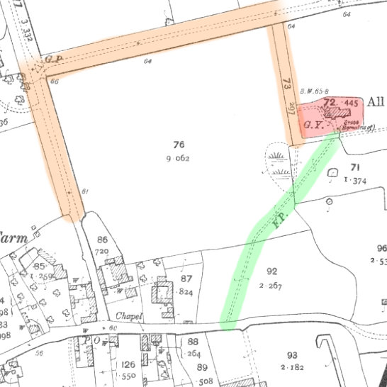
In the centre of the village, a footpath (green) extends from the western portion of the village, northeast to the church (red).
The present access to the church is from the north (orange), and if we look at those roads on the map, we see broad straight roadways and more right angles.
It is, therefore, possible that the footpath represents the medieval route to the church from the village.
7
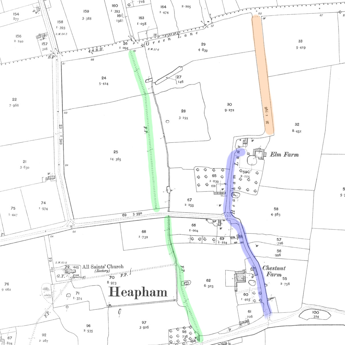
Further to the east, we have an interesting situation where we have a north-south aligned footpath (green) with a possible surviving medieval road (purple) to the east.
This could lead you to suspect that only one of these is of possible medieval origin, but if you look at the top of the map, the footpath joins to the western street of the settlement of Sturgate.
The eastern route (purple), past Elm Farm, has been straightened with another broad straight enclosure road (orange). You can see that it goes around the earthworks of the manor and its fields to link up with the eastern street of Sturgate.
What we could be looking at here is a common pattern of approximately parallel medieval roads, one of which forms the street, and the other forming a back lane running behind property boundaries.
8
One feature on the map, which is marked with a dotted line to the north of the village, is the parish boundary, which remains in place to this day. Research on parish boundaries across the country has discovered that most date back to the medieval period, and many go back further into the Anglo-Saxon period. It has been suggested that some date back as far as the Bronze Age.